


FARMLAND, Randolph County, Indiana
About
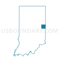
Outline

Summary
| Unique Area Identifier | 580259 |
| Name | FARMLAND |
| County | Randolph County |
| State | Indiana |
| Area (square miles) | 17.28 |
| Land Area (square miles) | 17.28 |
| Water Area (square miles) | 0.01 |
| % of Land Area | 99.95 |
| % of Water Area | 0.05 |
| Latitude of the Internal Point | 40.21434460 |
| Longtitude of the Internal Point | -85.13757950 |
Maps


Graphs
Select a template below for downloading or customizing gragh for FARMLAND, Randolph County, Indiana


Neighbors
Neighoring Voting District (by Name) Neighboring Voting District on the Map
- FRANKLIN, Randolph County, IN
- GREEN, Randolph County, IN
- PARKER, Randolph County, IN
- STONEY CREEK, Randolph County, IN
- WHITE RIVER 1, Randolph County, IN
Top 10 Neighboring County Subdivision (by Population) Neighboring County Subdivision on the Map
- White River township, Randolph County, IN (7,513)
- Monroe township, Randolph County, IN (3,711)
- Franklin township, Randolph County, IN (1,265)
- Stoney Creek township, Randolph County, IN (990)
- Green township, Randolph County, IN (957)